August 13th
Well today we left the Chesapeake. Heading South West from Cape Charles we went through the fifteen large cargo ships anchored waiting their turn for Baltimore or Norfolk. As we neared the channel into Hampton Roads we saw a military helicopter off towards the mouth of the Chesapeake lower something into the water and then drag it through the water at speed. This went on for about an hour before the helicopter went off to the naval base where it seemed to drop whatever it was towing. We have no idea what it was doing.


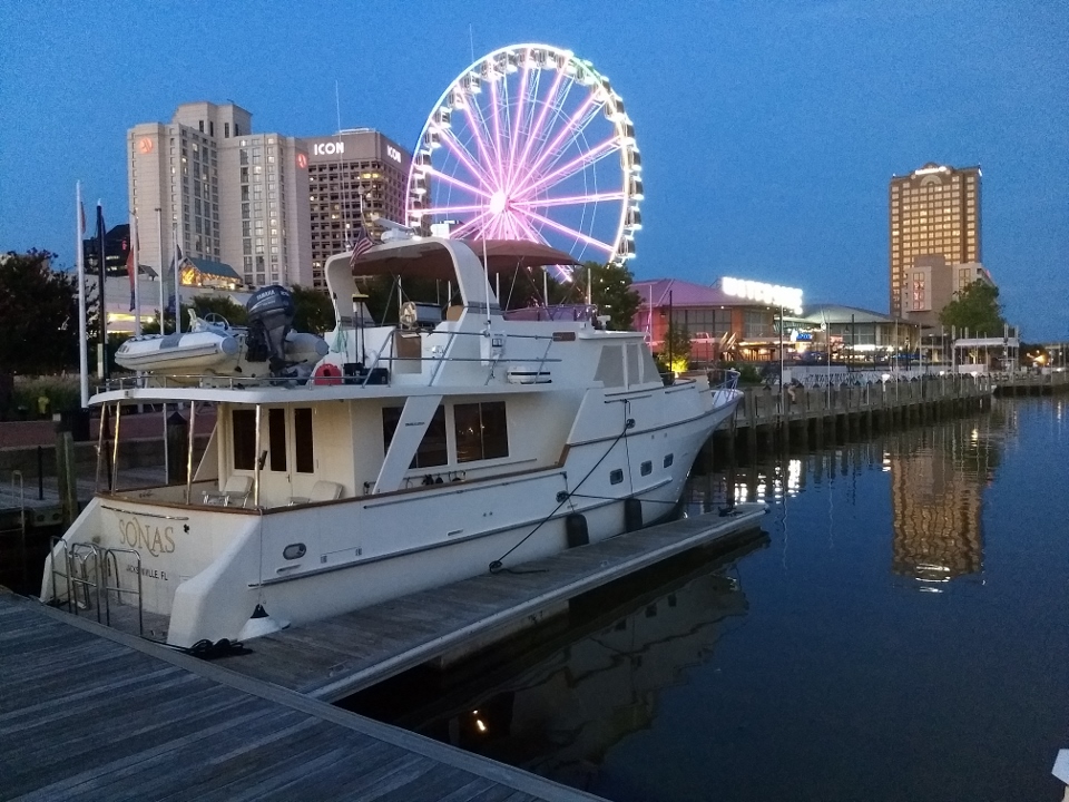
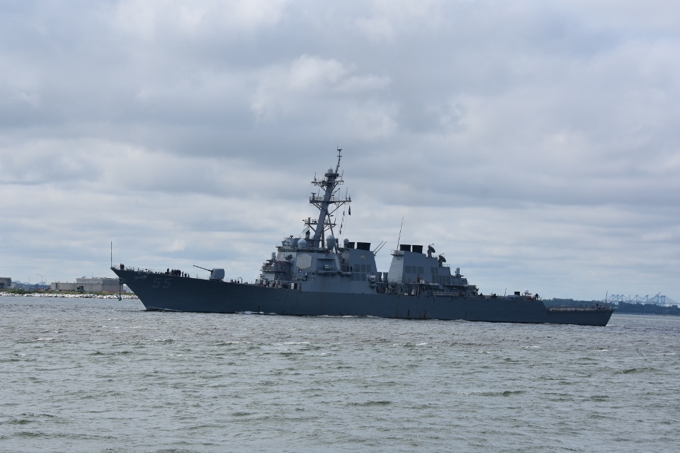
As we crossed into Hampton Roads we stayed to the north of the channel as warship 55 was exiting. After she passed us we crossed the channel and made our way past the Naval Station and down to Norfolk. We backed into our slip at the Waterfront Marina, right downtown.
The last time we were in Norfolk we had tried to get a boat tour of the shipyards and the naval station, but since it was the July Fourth week everything was booked up. So yesterday Paul went on-line and booked us onto the 5:30 tour. Since we were all tied up by one o’clock we went over to the ticket booth and changed our tickets to the two o’clock sailing.
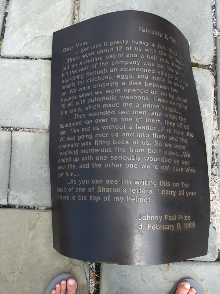
As we waited we visited the Armed Forces Memorial. This very well done memorial consisted of 20 bronze cast letters from service people who fought and died in all the major wars, the Revolutionary through the Gulf War. They were replicated on bronze and placed on the ground as if windblown.

Some of the letters:


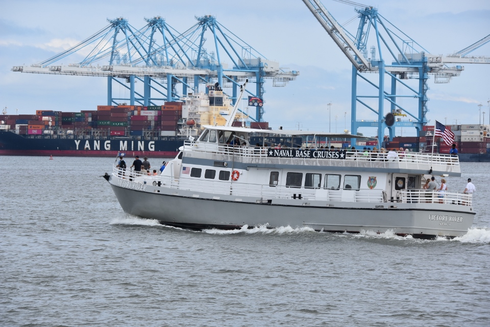
We boarded the Victory Rover which took us on a narrated tour of the shipyards and navy base. Each of the ship names and types were indicated along with the cost to build each. We were surprised to learn that most of the non-fighting ships, while owned by the navy, were managed and manned by civilian companies.
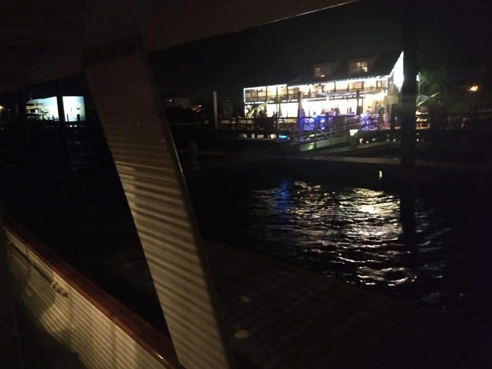
This evening we walked over to the Waterside complex and had Cioppino seafood dinners at Stripers.
August 14th
Today was one of the few days where we were staying in the same location for a couple of days. So we decided to get in some exercise. We put on our walking shoes and walked the Norfolk waterfront and the Freemason district for an hour. We had lunch on board and then headed over to Nautilus.
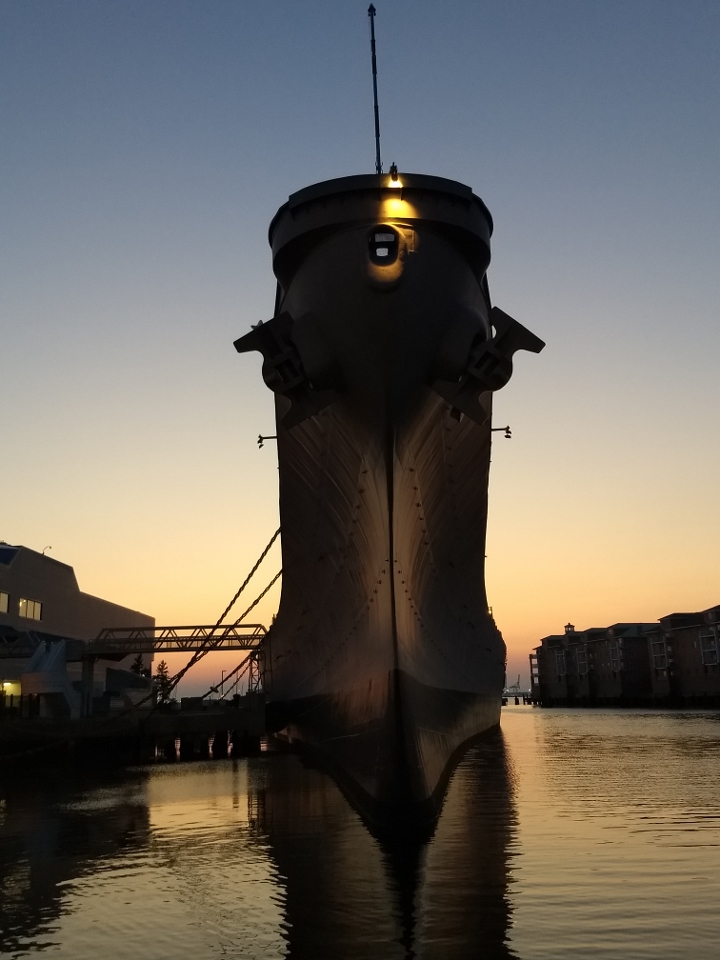
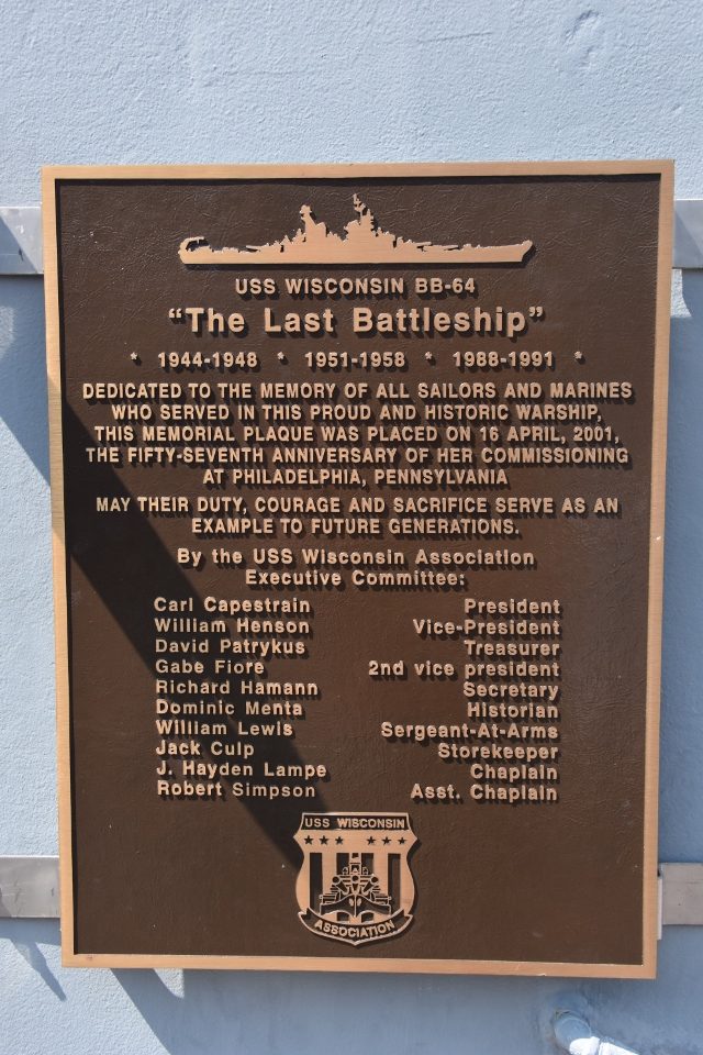
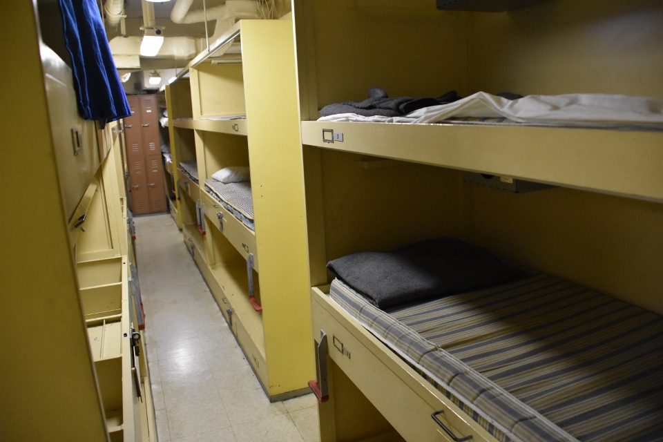
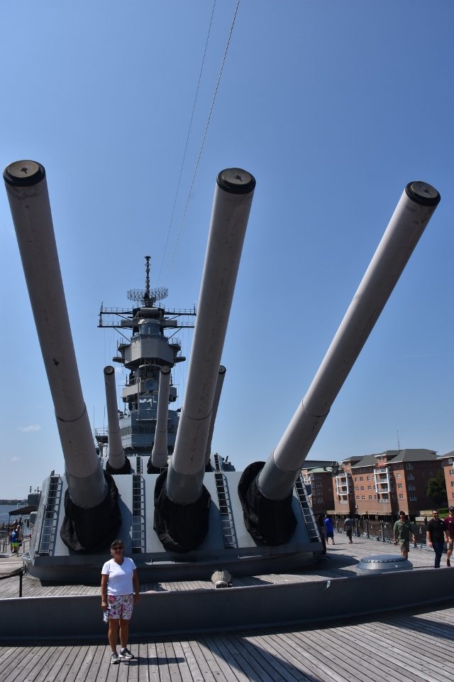
The Nautilus is part museum, part hands on for young adults and also home of the battleship Wisconsin. The museum was very well done, starting with the history and data on the Port of Virginia and the Norfolk Naval Base. It then covered ships communications and weaponry, the National Oceanic and Atmospheric Agency (NOAA), sealife in a small aquarium, plus 3D movies titled Blue Sea and Aircraft Carrier. We then toured the upper decks and deck two of the huge Wisconsin.
The museum also had a special exhibit underway called Shipwreck, with 500 artifacts recovered from shipwrecks, though we chose not to visit this.
Overall a very great value at only $16 – less for us seniors!
We got back to Sonas to tidy ourselves up and then walked the half mile to Freemason Abbey, a restaurant Sian picked up from TripAdvisor. This restaurant is in a refurbished church, with the original interior roofing and some of the original stain glass windows. The food and wine were excellent and economical. Our server Jordan was delightful. A very good meal indeed.
August 15th
Now it was time to head for home. We got out the charts and cruising guides and laid out our plan for the run inside to Beaufort and then, hopefully, outside to Jacksonville. We had two things we wanted to do along the way. Stop in Wrightsville in enough time to have dinner with cruising buddies John and Suzie Mc Carley, and also stop in Charleston for two nights giving us an evening and full day to enjoy that beautiful city.
Today we aimed to do 61 miles, timing the lock and bridge at Great Bridge, and passing Coinjock to anchor in the North River. We made the Great Bridge Lock at 8:30 which was perfect timing to get through the lock and straight onto the nearby Great Bridge bridge for their 9:00am opening. Just like clockwork.
The next challenge was the Centerville Bridge. It opened on the hour and half hour. Since it was just 3.2 miles away and we had 25 minutes to make it we pulled back on the throttles with the aim of getting there right at the 9:30 opening.
Then a power catamaran popped out of a marina and fell in behind us. As we got to within a mile of the bridge I switched to the bridge channel 13 and advised the bridge tender that we were approaching southbound and would be standing by on channel 13 for their 9:30 opening. He acknowledged.
A minute or two later it got a bit weird!
Catamaran on 13: “Bridge we are the catamaran behind Sonas wanting to pass them to get to your bridge, but we can’t raise Sonas on channel 16, they must not have their radio on.”
Bridge on 13: “Just pass them then.”
Me on 13: “This is Sonas, we had already contacted the bridge and were monitoring the bridge channel 13.”
Catamaran: “Ok, we will come behind you.”
Catamaran a minute later: “Actually Sonas can we pass you on your starboard side?”
Me: “Roger I will move to port to give you room.”
Catamaran: “No sorry, we want to pass you on your port side.”
Me: “Roger I will move to starboard to give you room.”
The catamaran then passes us towards the bridge. We continue at our decreased speed timing the bridge opening.
Catamaran to bridge: “Bridge we are approaching, do we have to wait for Sonas before you will open the bridge?”
Bridge: “I will be opening the bridge in a few minutes.”
Catamaran slows to wait for the 9:30 opening, which by the time the tender drops the road barriers and open the span, is more like 9:33. By which time we go through the bridge right behind the catamaran. I smile broadly at the bridge tender and he smiles back.
And on we went! Some of us smelling the roses, some of us burning the diesel!
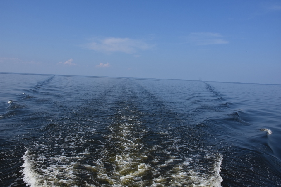
We got to the anchorage at the North River at two o’clock so decided to keep on going as the weather was perfect for crossing the Albemarle. We crossed the sound in glassy water and anchored just the other side at mile marker 81 on the Little Alligator River along with three other boats.
August 16th
Under way at 7:00. We decided to do another 80 miles today, which would get us to anchorage inside Bear Creek just north of the Neuse River. Our plan was to give us a half day run to Cape Fear the next day where we would anchor and have a relaxing beach day.
Our first challenge of the day was getting through the Alligator River Highway Bridge. This is a swing bridge with only a 14 foot clearance when closed. We radioed the bridge tender as we approached. He told us to come on down and he would open it. As we approached he asked us to stand by and they only had one lane of traffic open, and there were men at each end of the bridge releasing traffic in alternative directions. We waited until the traffic flowing eastbound passed by. Then we waited until traffic flowing west bound passed by, then the bridge opened and we were told to continue. Thankfully this was to be the last bridge opening request today and, if we can run outside from Beaufort, the last one of the trip!
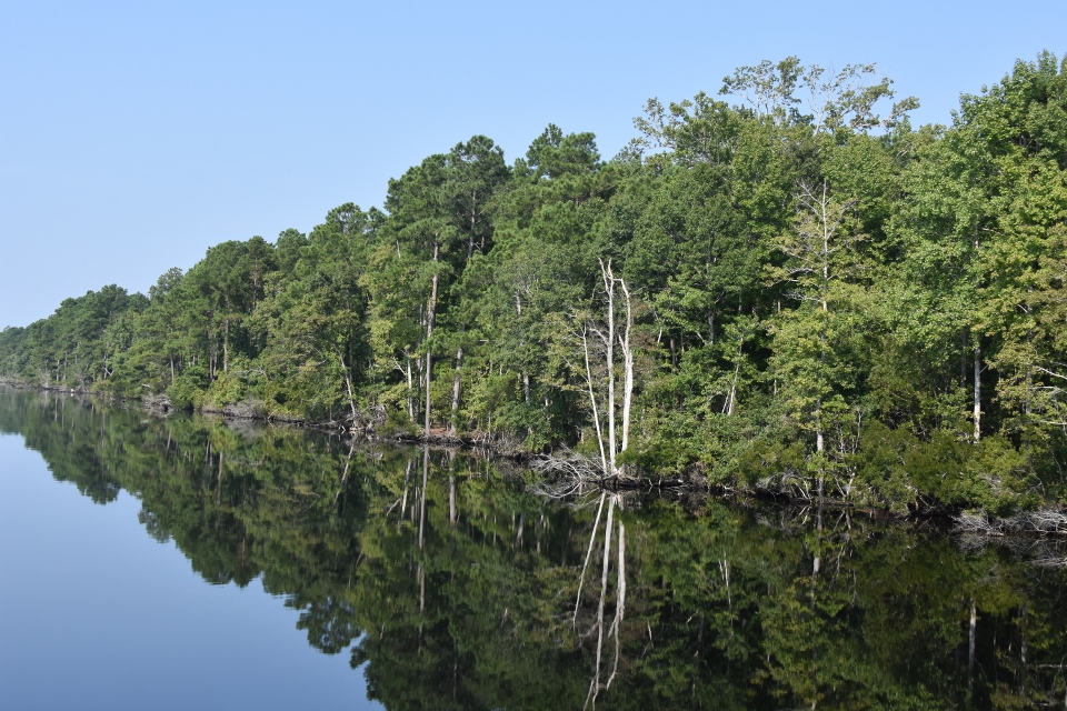
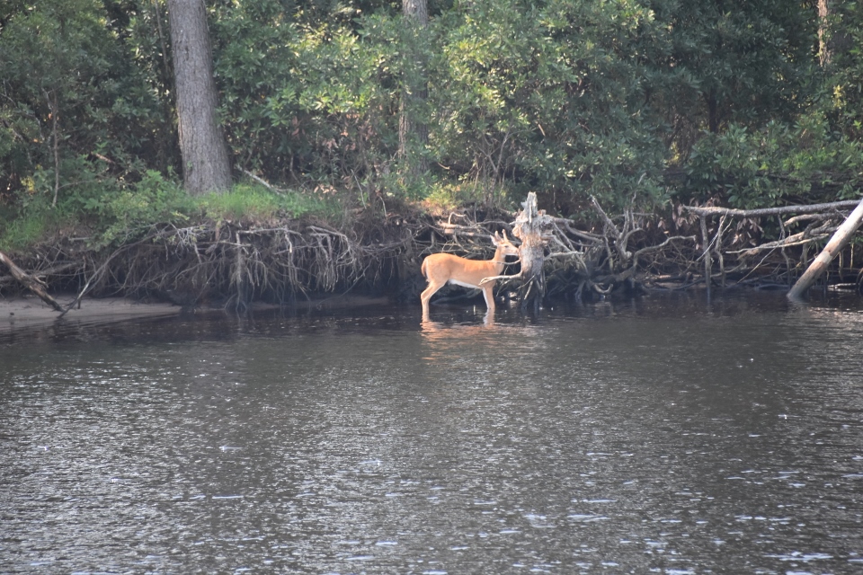
We continued south through the Alligator River and arrived at the Alligator and Pungo Canal. This canal is 21 miles long and is probably the most boring part of our trip (as it was on the way up!). We got through the canal without incident, seeing a young deer along the way, transited the Pungo River and across the Pamlico. We arrived at our anchorage at mile marker 161 around 4. We managed to get the anchor down and get below before a lighting storm hit, which passed without causing any issues. It was blowing quite strongly so we laid out one hundred feet of chain just to be on the safe side.
Jacksonville is at ICW mile marker 734 – so only another 573 miles to go!!
August 17th
Today we aimed to get to the Beaufort Inlet, nip out there and across to the Cape Look Out Bight. Inside the bight there is a great anchorage, well protected from wind from any direction, with wonderful sandy beaches. We could swim and walk the beaches. Then the next day we can pop out from the Bight and head south west on the outside for our next anchorage at Wrightsville Beach.
Well, it didn’t take long for that plan to unravel. By the time we have crossed the Neuse Rived and north of Morehead City the wind was blowing a gale. Paul checked the weather and found that North Carolina was sitting right between a high pressure a low pressure trough, and would likely be so for most of the coming week! We checked the sea conditions and found that the waves were 3-4 feet, building to 4-5 feet tomorrow running from the south west! The boat would be fine, but who wants to spend seven or eight hours pounding straight into five foot waves?
So we decided to stay inside. We grabbed the charts and cruising guide and targeted Swansboro as a good stop for today. We got to Morehead City, turned into the AICW south and continued to Swansboro buffeted by 20 knot winds. We called the town docks and reserved their T-Head, which was open.
We urned into the creek leading into town, and saw that there were two center consoles taking up the T-Head. We held off the T-Head in a strong current (and still strong wind) until a guy sitting in his Ranger Tug saw us. He went off and found the boat owners and got them to quickly move their boats. He then came down to the dock and helped us tie up. When we were all secure Paul went over with a six pack and our thanks. Dave introduced himself and they chatted about the area for a while.
We then went for a walk around the quaint waterfront area of Swansboro. There are a number of unique stores, a candy store, and a café that sells beer and wine making products, craft beers and wine. They also do evening wine tastings.
After cleaning up we left Sonas to go eat at The Ice House. On our way up the dock Dave called us over and introduced us to Michael, who runs a sailboat for hire out of the dock. He does sailing education cruises and sunset cruises.
After dinner we sat on the back cockpit with a glass of wine, later joined by Michael and his “crew” Shannon.
August 18th
This morning we had to pour over the charts and cruising guide and work out our plan for getting from Swansboro to Wrightsville Beach, out next stop. While it was only 54 miles in distance it was complicated by the fact that there were four low bridges that we had to go through that were restricted to either half hourly opening or hourly openings. We had to time our departure from the marina to meet the first bridge and then the run between each bridge. Another potential complication was that Marine camp Lejeune was also on our route and they could have live fire exercises that would close the ICW to traffic.
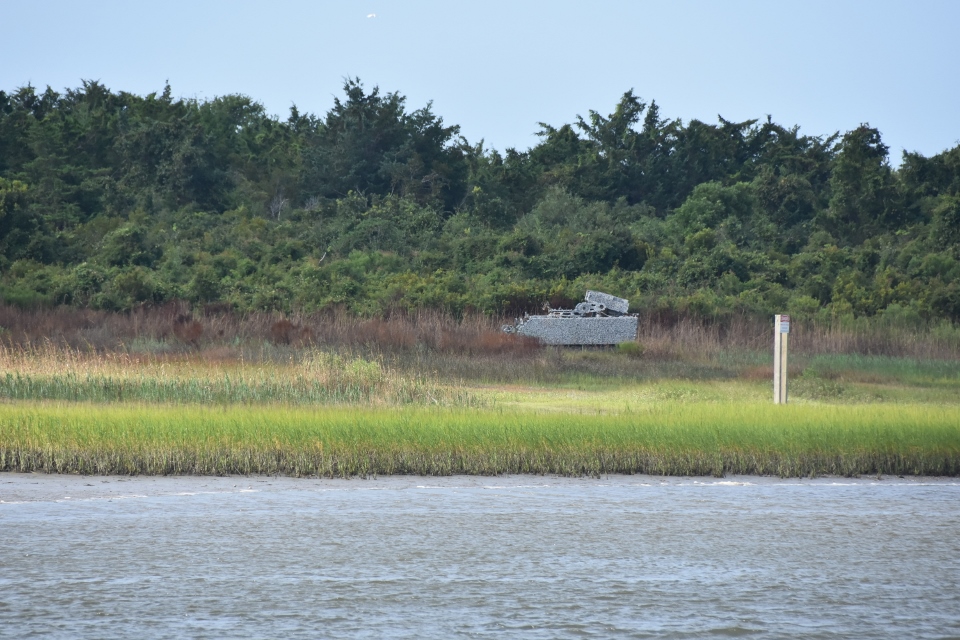
Six miles after leaving Swansboro we saw the control tower for Camp Lejeune, and the warning signs. The good news was that there were no exercises planned for today. As we passed through the camp we saw additional warning signs and the results of their previous live fire practices!


Then we started our timed runs through the bridges!
- The Onslow Beach Bridge 11 miles away (0nly 12 feet clearance when closed) opened every half hour. So we got under way at 8:15 to make the 9:30 opening. Which we did without issues.
- Then it was the Surf City Highway Bridge, 20 miles away (12 feet clearance) which only opened on the hour. We gave ourselves a relaxing two and a half hours to get there, again done without issue for the 12:00 opening.
- Now the Figure Eight Island Bridge, 17.5 miles away (20 feet clearance) which opened every half hour. We needed to get there on the half hour because the bridge after that was 4.8 miles away and only opened on the hour, and we only needed a half hour to do that final run. So we gave ourselves two and a half hours to make the Figure Eight and made it with plenty to spare for the 2:30 opening.
- Then we had a problem. We hadn’t factored in the fact that it would take five minutes or more for the bridge to open and for us to get through. Meaning we didn’t have a full half hour to do the nearly five miles to the next bridge! AND we got hit with a bit of a head current! We usually cruise at 8 knots (9.2statute miles). If we missed the opening we would have to hang around another hour for the next opening! So we cranked up the RPMs and prayed! At 2:55, when we were about a mile and a half from the bridge Paul called the bridge tender and told him we were a mile out and standing by for the opening. He acknowledged. Four minutes later he called us back and asked us if we would make it as he could not wait! We cranked some more (and maybe went a wee bit too fast through a congested area!). The tender then raised the bridge and called us to tell us that there was a boat coming the other way so by the time he got through we would be fine! In fact he did keep the bridge open for a couple of extra minutes for us to get through, especially since there were a number of smaller boats ahead of us that we had to slow down for! We radioed and thanked him profusely!
On the way through all this we ran aground at the junction of the New River and ICW. This is a three way junction. The inlet coming in, the ICW crossing it, and the river continuing to Jacksonville, North Carolina. There are red buoys going in all directions. The Coast Guard have placed two red can buoys there so that they can move them around with the shoaling. We bumped the nose of our keel aground when our depth sounder was showing eight feet (the transducer is on the middle of the boat) so we were able to back off easily, then in the supposed middle of the ICW channel between the two can buoys we passed one point with only one foot under the keel. With the help of a couple of folks fishing and a passing jet skier we were able to get past the confusion and on our way.
After tying up at the marina we contacted John and Suzie McCarley and told them we had arrived. We arranged to meet for dinner at six and had a nice meal at Bluewater Grill.
One thing we discussed at the end of this day is that we also have tricky areas in the ICW where we live but we move around with confidence because we know the waters and have local knowledge. We watched today as dozens of other boaters flew around us as we worked our way around some very skinny water, and it certainly has brought home to use the immense value of local knowledge.
August 19th
We decided to stay inside again today as it was still blowing hard. We set off from Wrightsville Beach, southbound on the ICW. Our aim today was to get to the Anchorage on the Little River, just inside the inlet and below Calabash.
The trip along the ICW was uneventful except for the fact that we were running during low tide AND the tide times are later going south so we were following the lowest water as we went along! This really didn’t give us much of an issue except at the intersection of inlets. Every time we got to one of these there was shoaling and we had to go slow and search for the deepest water. It got to be very tedious.
At one inlet intersection we were behind a small trawler who hailed us as we came to the inlet, and asked to switch to a working channel.
“Sonas, this is XYZ ahead of you. If you like we can give you water readings as we go through here?”
Of course we said yes! Then all of a sudden:
“Sonas we are seeing three and a half foot!!!” Then they swerved to starboard.
“Sorry about that Sonas, we mistook the inlet markers as the ICW markers and were cutting the corner. We are fine now!”
Looking at the markers we can certainly understand how they made that mistake and, as Sian said “we’re glad you are leading the way!”
We ended up passing through in 12 feet of water! Soon after passing the inlet intersection we overtook the small trawler.
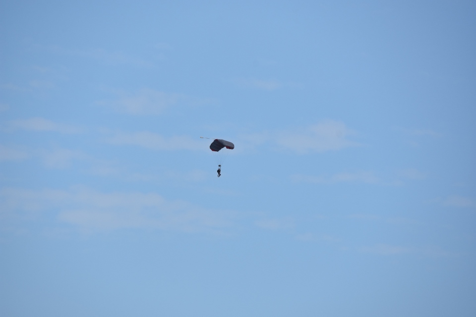
The rest of the day was uneventful, we saw some sky divers parachuting down to a field beside the ICW, and saw dozens of “Slow, no wake” signs put up on private docks with the requisite red circles, and not one of them legal! We reached the anchorage for an early stop at 2:00. We are checking the weather for tomorrow and it looks like we can finally run outside to Georgetown Inlet to anchor and then afterwards to Charleston.

Paul,
Thanks for the reply, which explains why I never saw your “3rd person” in your photos!
Really enjoying your trip! Also, have you on Marine Traffic.
Happy voyage!
The helicopter may have been lowering a sonar into the water.