Let us start off by saying we had absolutely no issues getting from Marsh Harbour, Abaco to 18 nautical miles south east of Fort Pierce. Then our challenges started. Stay tuned for the “rest of the story!”
Saturday May 5th. We set the alarm to make sure we were up, dressed, coffee made, and boat prepared for crossing Whale Cay. Finally the wind had calmed and move around to the south east. By our reckoning we were good to go.
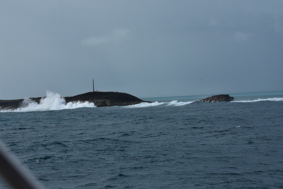
We lifted the anchor and started out of the harbour. We had a number of people pop their heads out of their boats to see who was leaving, including a lady in her nice nightgown, but no other boat out of the dozens there made a move. Hmmm, were we sure we had this right? We put the waypoints into the GPS and put Whale Cay on our bow. Two hours later we were through. There were four to five feet swells rolling in from the Atlantic, but no waves or white caps. Sonas handled it perfectly. As we made the turn to the northwest we were contacted by two other boats asking us about the conditions, and then later another boater, still on his mooring in Green Turtle, asked us the same. We relayed the sea state.
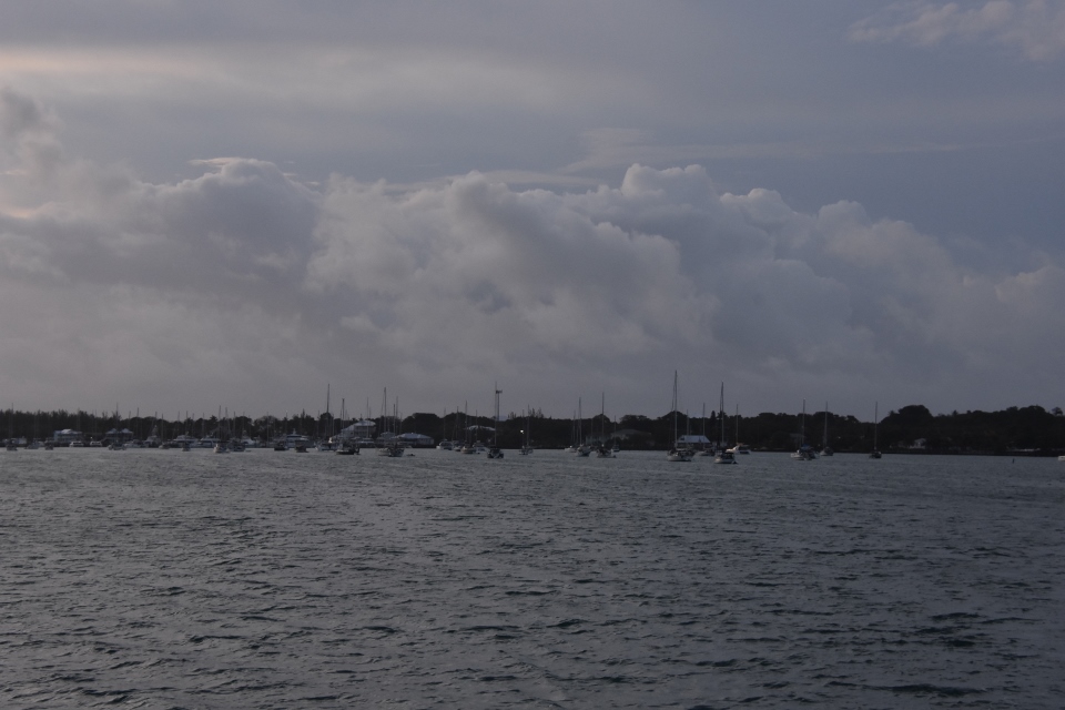
From there to our first overnight stop at Mangrove Cay everything went as planned. Mangrove is one of the first cays you hit when you get onto the Bahamas Bank and one of the last you can stop at before you make the leap across the Gulf Stream. We arrived just before seven to find a half dozen boats already anchored and joined them. As we sat in the cockpit enjoying a cocktail we saw a number of sail boats come by and carry on into the gulf stream towards Florida. Because they move so slow many sailors chose to make the passage overnight, if the weather is cooperating, so as to arrive in Florida in daylight. We had just finished a twelve hour run and were pretty tired and can only imagine how worn out these good people must be by the time they make landfall.
Sunday May 6th. We had a so-so night’s sleep. Initially Mangrove protected us from the south west wind, but overnight it went to the south east.We were then exposed somewhat and the boat bounced around a bit. Nothing worrying, more annoying. We had our alarm set for 5am. Sunrise wasn’t until around 6:30 but the anchorage was easy to get out of in the dark and we wanted to get a jump on another long day. We got off around 5:15 and ran the first hour or so in the dark. Daylight brought us fine sailing weather, light winds from the SSW and a moderate sea. We managed to catch the WX (NOAA weather) station from West Palm so heard that our crossing would be pretty uneventful – 3 footers in the stream.
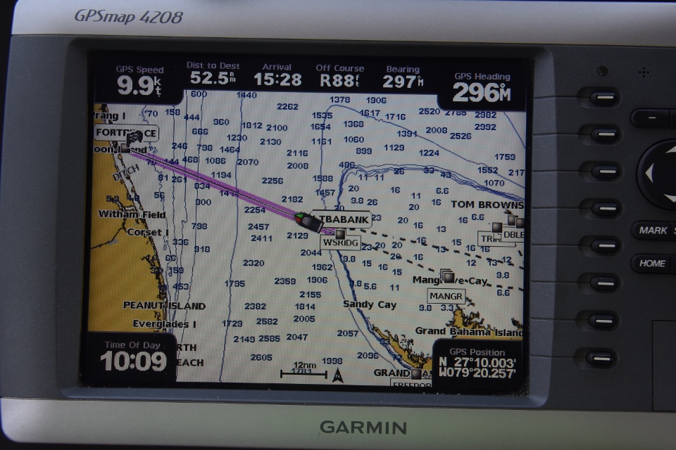
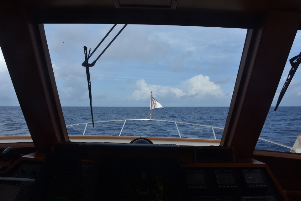
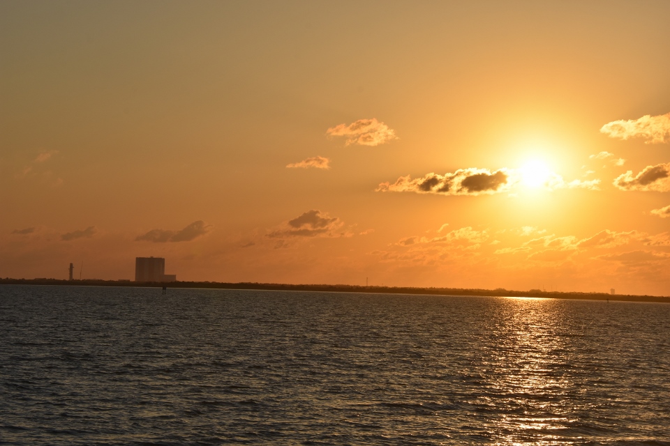
After four hours we crossed from the Bahamas Bank and into the stream, and pointed to the waypoint for Fort Pierce. The GPS told us that our estimated time of arrival at the inlet would be 3:30pm. We passed a few Bahamian fishing boats but very little other boat traffic. A few hours in a beautiful downeaster called Firefly crossed our bow and radioed us, saying “nice to see another boat out here!” We had a nice long chat before they continued on their route to Port Canaveral.
The rest of our trip across was uneventful, in fact we would say tedious – but that was OK given what we faced coming over!
Then, just as our GPS showed 18 NM to our destination, things took a wrong turn – literally!
A plane flew directly over us, then over the VHF came: “trawler at location XYZ, this is navy plane overhead.” We looked at our latitude and longitude and yep, they meant us! Paul replied and they took us to their working channel. The conversation went something like this:
“This is trawler Sonas to the navy plane.”
“Sonas, we are doing live fire exercises in this area. You are two miles into our box. We need you to turn to the south for two miles and then head toward land until you are within ten miles of shore and then you may proceed staying within ten miles of shore.”
At that time we were being pushed along nicely by the Gulf Stream. Turning south meants going directly into the stream. So Paul asked:
“Navy plane, can we head north until we are out of the box and then proceed towards land?”
“Negative Sonas. You must head south and out of the area.”
“Roger navy plan. Changing course now.”
“Thank you Sonas.”
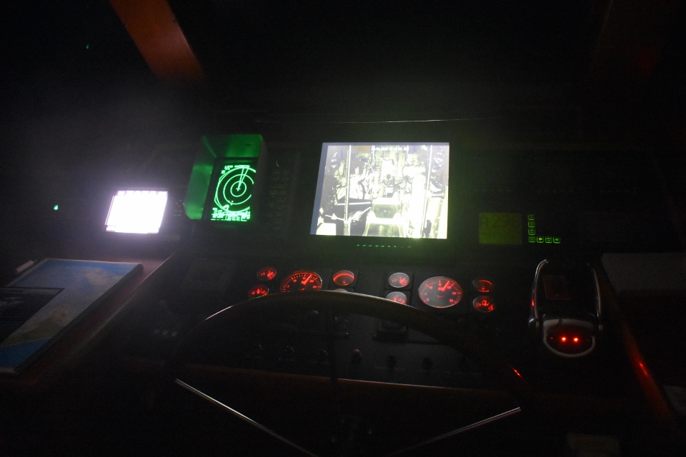
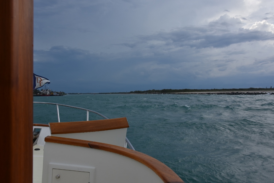
We had been making around 10 knots up until that point with the help f the stream. Once we turned into it that help turned against us and we crawled to 5 knots. We finally got out of the “box” and headed towards St Lucie. And a number of rain squalls! We managed to use the radar to avoid most of the squall and finally were able to turn towards Fort Pierce again once inside ten miles of land. But now we started to get wind in the 23-25 mph range. It was on our stern so not really an issue – until we finally got to the Fort Pierce inlet. There was a strong outgoing tide, and the seas from the south were crossing this current, making for a very unsavory inlet. Paul turned off the auto pilot and the engine syncronizers and took manual control. We nearly made it through but just when Paul said “sixty more seconds to calm waters” we were hit by a huge wave that broached us sideways. Paul got control back but furniture went a-tumbling!
But we were in!
We eased back on the throttles as the inlet is a slow zone. We had originally planned to get in around 3:30 and then run a couple of hours north before anchoring and calling Customs and Border Patrol to process in. Since we had the navy detour we decided to anchor just off the ICW inside the inlet.
AND…. just as we approached the turn for the ICW a Coast Guard boat appeared and called us the VHF.
“Vessel Sonas, this is US Coast Guard vessel. What was your last port of call and where are you headed?”
“The Bahamas, and we are going to put down anchor right ahead and call CBP.”
“Sonas, we are going to board and do an inspection.”
And so they did. Two young men, armed but very polite, came aboard. While Paul kept Sonas steady on the ICW, Sian took them around the boat showing them flares, PFDs, bilges, engine room, Fire Extinguishers, Inland Rules to Navigation book, etc. etc. We passed the inspection and were given our “You Are Gold” copy. This supposedly helps keep us away from another inspection for six months or so – but is not guaranteed to do so!
Waving goodbye to our new friends we finally put our anchor down right outside HarboTown marina by the ICW. This is the same anchorage we used before we crossed to the Bahamas.
Next step was to call into the Customs and Border Protection 1-800 number. We are enrolled in a program called the Small Vessel Reportng System and had filed a float plan. All we needed to do was call them and, so long as everything checked out, we would not have to report in person at Fort Pierce airport. But there was a problem:
“Hello, we have returned into the US And have a float plan.”
“Sorry sir we no longer use SVRS. It was discontinued a month ago.”
“But I left the country two months ago, how was I to know.”
“We now have an smart device app called ROAM. Download that and fill in your information and we can process you.”
“Oh, OK. I will do that right away. Thank you.”
So Paul downloaded the app. It seemed pretty straight forward and intuitive. You enter the personal details of those on board , their passport number, their SRVS registration number, and a photo of the passports. You also add details of your vessel and answer the usual questions about where you have been and what you might be bringing into the country.
Well pretty intuitive until it isn’t!
Paul completed everything and then pressed “submit” to have the entry reviewed by a CBP officer. He received a screen back saying “pending review.”
So, that done, we went to he pilot house to have dinner.
After dinner and clearing up, Paul went back to the phone to see if the status had changed. He then saw that he had missed a video conferencing call with a CBP officer. He had also received an message two minutes after the video request saying:
Thank you for your recent U.S. CBP ROAM submission. Unfortunately, your U.S. CBP ROAM Trip ID XXXX has not been approved and you may not enter the U.S. at this time. You may contact the nearest Port of Entry for information or clarification.
Sincerely, U.S. Customs and Border Protection
What?
Paul called the 1-800 number back and it was explained to him that the app worked real time. When you submit an entry request an officer gets it right away and either accepts it or requests a video interview. Since we did not accept the video interview he rejected our submission. The officer told Paul to go ahead and resubmit and that he would pick it up (using our phone number) and process it again. Paul did so and we were successful.
Obviously there are still some teething issues with the process (for example the app user could be taken through a tutorial on first installing the app) but it is a very neat way of using technology to handle recreational boat traffic into Florida.
The winds melted away to light breezes which moved Sonas around the anchorage sedately. We sleep the sleep of the innocent.
And awoke the next day well aground!

Monday May 7th. We noticed that all of the other boats at anchor were pointing one way into the wind and we were pointing another. That was the clue that the tide had gone out and left us aground. We called Sea Tow (our AAA on the water). He said he would be there in 40 minutes. He arrived and spent about an hour trying to pull our bow into deeper water. He eventually gave up and told us that he would come back at high tide and try again. After about 30 minutes Paul walked to the bow and noticed that that the bow was jammed onto a mound of shale. He walked to the stern of Sonas and grabbed our long boat hook. He stuck the boat hook into the water until it hit sand and measured the depth. It was six feet, We only needed five feet to float It seems that the outgoing tide had placed our bow on a shallow shelf but the rest of the boat in water deeper water. So Paul started the engines and powered us into reverse and we were off!

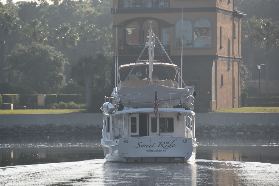
We entered the ICW and started our journey north.Paul grabbed he chart book and, given our late departure, targeted an anchorage just south of Titusville, to the south east of the NASA Causeway bridge. We arrived at the anchorage around 7:00 and hailed a Kady Krogen named Sweet Ride which was already in there. They confirmed that we would have enough depth so in we went and dropped the hook. The wind died to a light breeze overnight and we had a very quiet sleep full night!
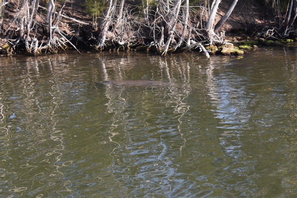
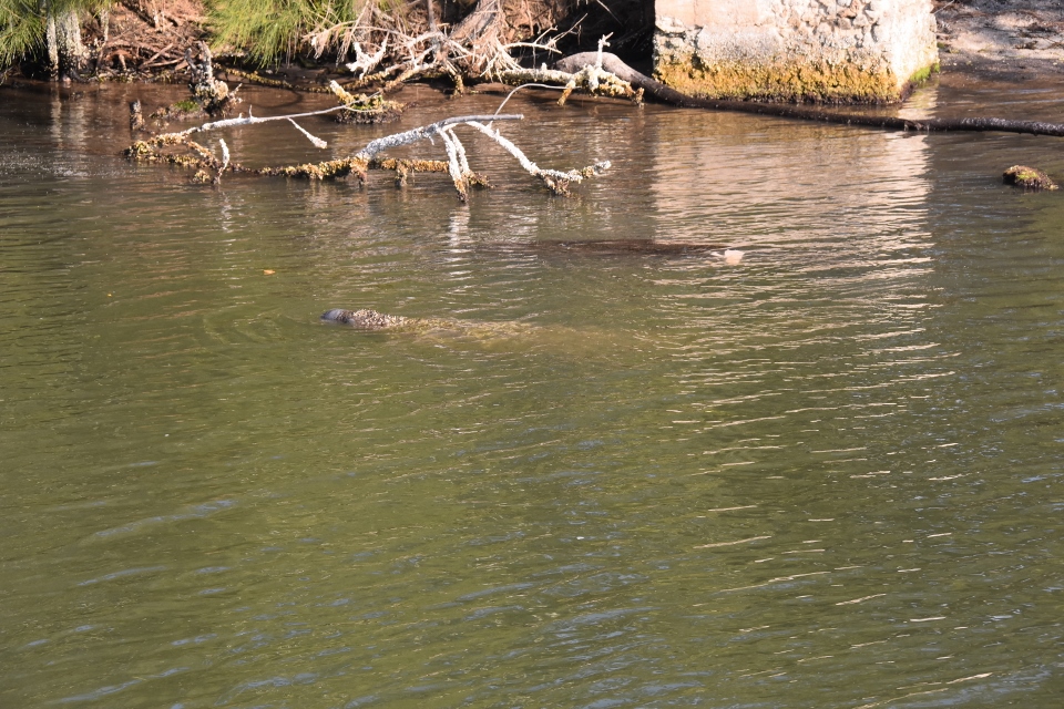
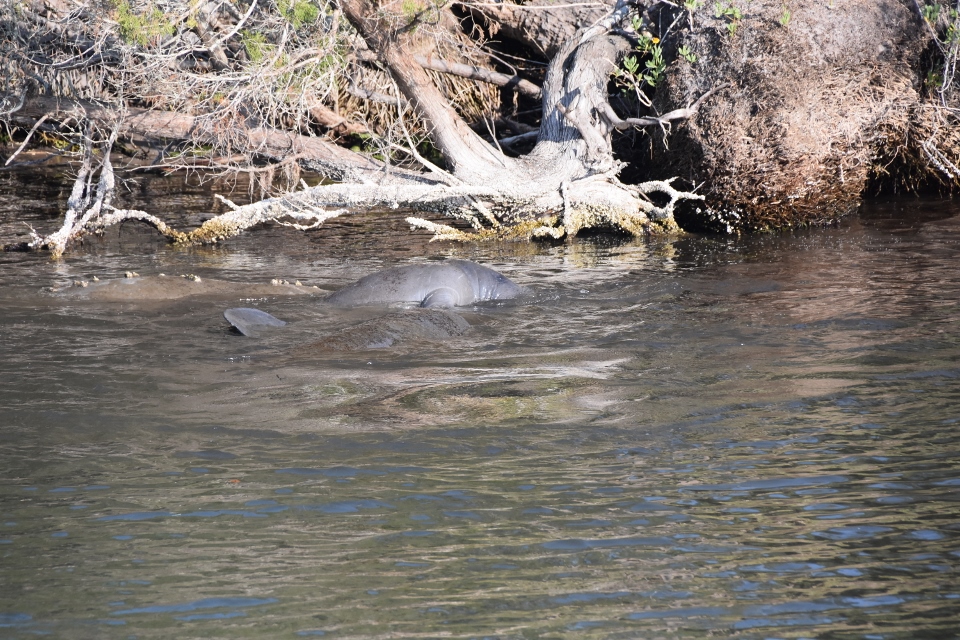
Tuesday May 8th. We upped anchor just before 7:00 and again headed north through Titusville and towards Haulover Canal. On entering the canal we saw movement in the water ahead of us. Manatees! Then more manatees, and more again! We saw around thirty or forty mainly along the north edge of the canal, and quite a number right in the middle of the canal that we had to avoid. There was even one attached to a small buoy – we suspect that it had been tagged for research.
We left the canal and headed through Mosquito Lagoon, and into New Smyrna, then Daytona, and finally Palm Coast, arriving at Palm Coast Marina around 4:00pm. We had passed the Kady Krogen Sweet Ride in Daytona and a half hour later she also came in to the marina and tied up beside us.
We walked into the European Village and had a seafood dinner at Lisbon Nights. Sian has Sea Bass and Paul had the Portuguese version of Paella, which included a lobster tail! We returned to Sonas and sat on the back deck with a glass of red. Christopher and Alexandra, the owners of Sweet Ride, came by and we had a nice chat for a half hour or so.
Wednesday May 9th. We are on the last leg of our trip and on our way home today. Since it will “only” take us six hours today we had a later start, leaving the marina at 8:00. High tide at Queens Harbour was 6:00pm so we were looking to arrive at the channel around 3:00pm.
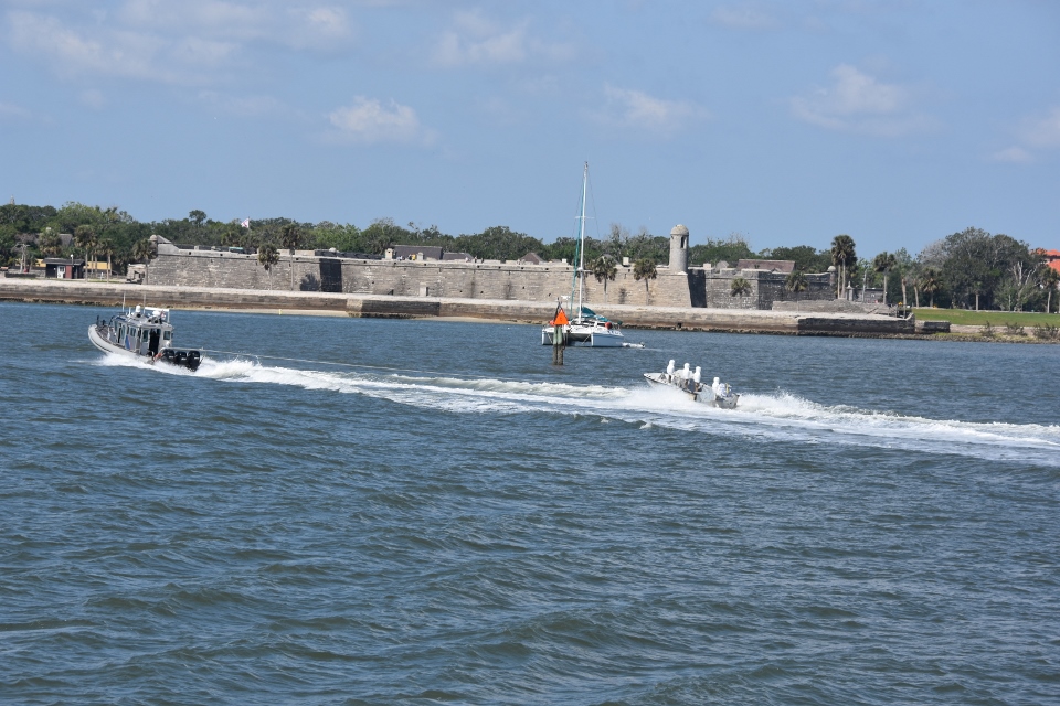
AS we passed through St Augustine we were passed by a half dozen Customs and Border Patrol go-fast boats, then we saw this coming in the inlet – seems they were having a bit of target practice out there!

We arrived outside the Queens Harbour lock around 2:30 and were tied up at home dock at 3:00.
Another Bahamas trip completed!
Well done to you both .. that was some journey … relax now and have a big glass of vino ❤️❤️❤️… see you soon
I was keeping up with your posts of your Abaco trip, and was hoping to run into you to say hello but I never saw Sonas.
We live in Man-o- War Cay, but I cross over to Marsh Harbour daily where I work.
I look forward to meeting up with you some day.
Scott
Just checking in and it’s so nice to read about your recent trips and adventures. We are having fun here at J&J, and we certainly miss you, Paul. Keep exploring!!